Services
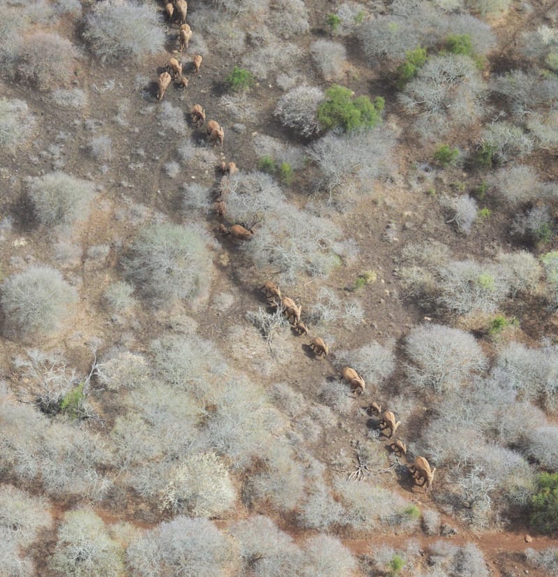
WILDLIFE AND LIVESTOCK POPULATIONS AND DISTRIBUTIONS
We specialize in gathering, indexing and interpreting large volumes of high-resolution aerial images (24 - 61 MegaPixel) for African wildlife, vegetation and human variables. We compile the geo-referenced information into comprehensive Excel meta-databases for population analysis (for example "Jolly II") and for deployment to clients for their own needs.
Learn More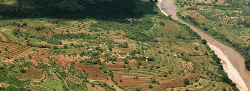
LAND USE ASSESSMENT AND AGRICULTURAL INVENTORY
We implement surveys using aerial-point-sampling (APS) methods to assess land use and crop systems, and implement agricultural inventories. Using high-resolution digital cameras, we map crop types at a resolution of 3 cm ground-sampling-distance (GSD) to derive land budgets at the scale of districts and regions.
Learn More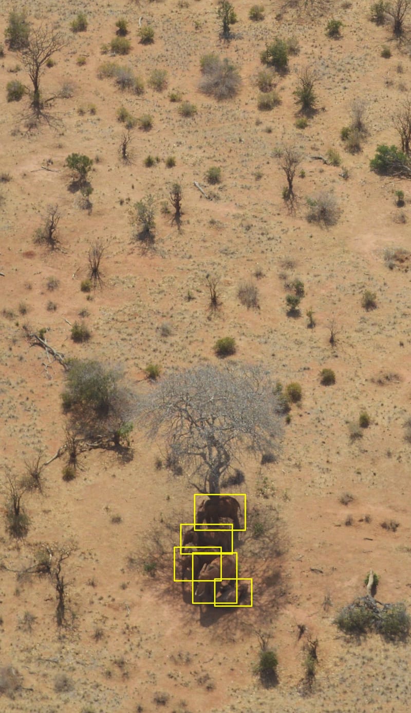
ANNOTATION FOR MACHINE LEARNING
Wildspace-Image-Analytics provides precise annotation for machine learning to help teams build high-quality training datasets for computer vision and AI models. We deliver consistent, scalable labels tailored to your taxonomy and use case to improve model accuracy and reduce time-to-deployment.
Learn More