LAND USE ASSESSMENT AND AGRICULTURAL INVENTORY
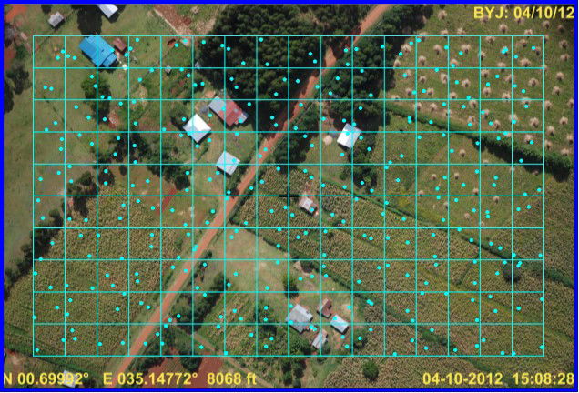 | 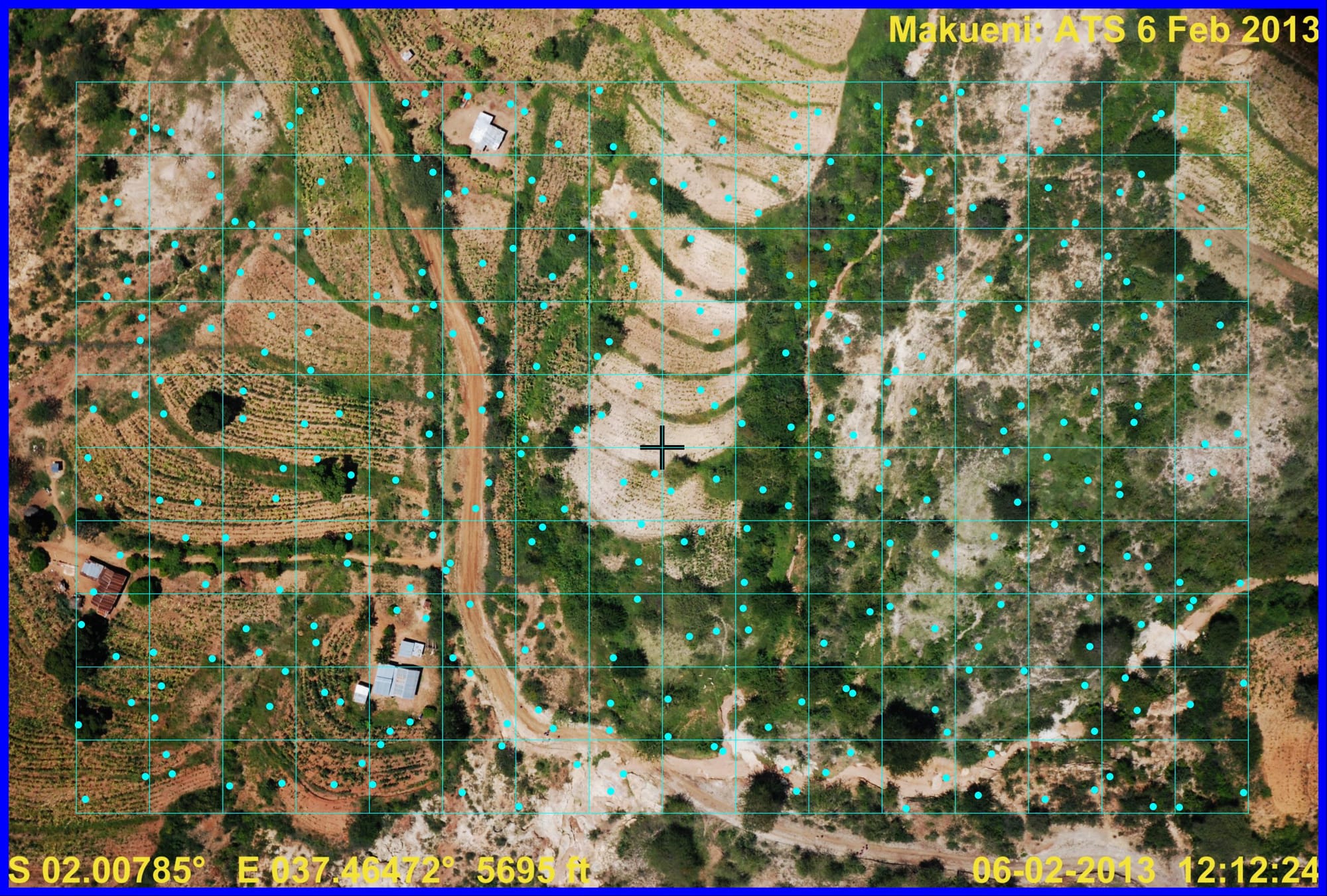 |  |
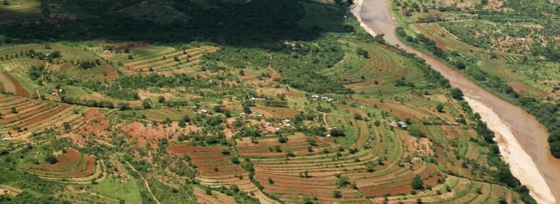
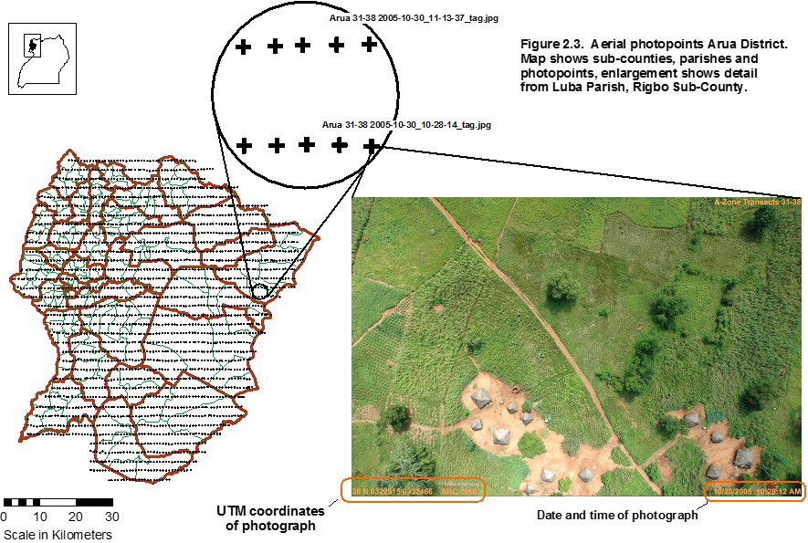
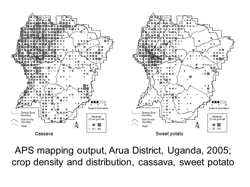
We have developed the use of small format digital cameras for aerial-point-sampling (APS), a method developed by Dr Mike Norton-Griffiths in the 1980's to estimate crop cover and land use1. Using APS, we assess over 20 crop types, including:
- Staple subsistence crops: Maize, beans, cassava, rice, banana
- Supplementary subsistence crops: Sweet potato, groundnuts, sorghum, millet
- Cash crops: Tobacco, sunflower, cocoa, sugar cane, cotton, sisal, horticulture
- Agro-forestry: Plantation forestry, woodlot, orchard
- Access and fallow: Fallow, field dividers, access roads
- Settlement: Rural, compound, tin-roof, grass-roof,
- Natural Vegetation: Forest, riparian forest, bushland, grassland, wetland
Our clients include:
2012: International Centre for Research in Agro-Forestry (ICRAF): Land Use of Kenya Lake Victoria Basin, and Makueni and Kiambu Districts. See article:
Marshall, M., Norton-Griffiths, M., Herr, H., Lamprey, R.H., Sheffield, J., Vagen, T., and Okotto-Okotto, J. (2017) Continuous and consistent land use/cover change estimates using socio-ecological data, Earth Systems Dynamics, 8, 55-73, doi:10.5194/esd-8-55-2017, 2017.
2005: Uganda Bureau of Statistics and Belgian Technical Cooperation (BTC): Aerial land Use Survey of Four Districts of Uganda,
1: Norton-Griffiths, M. (1988) Aerial point sampling for land use surveys. Journal of Biogeography 15: 149-156
 |  |
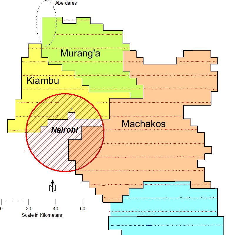 APS survey flight diagram, Murang'a and Machakos, 2013 APS survey flight diagram, Murang'a and Machakos, 2013 | 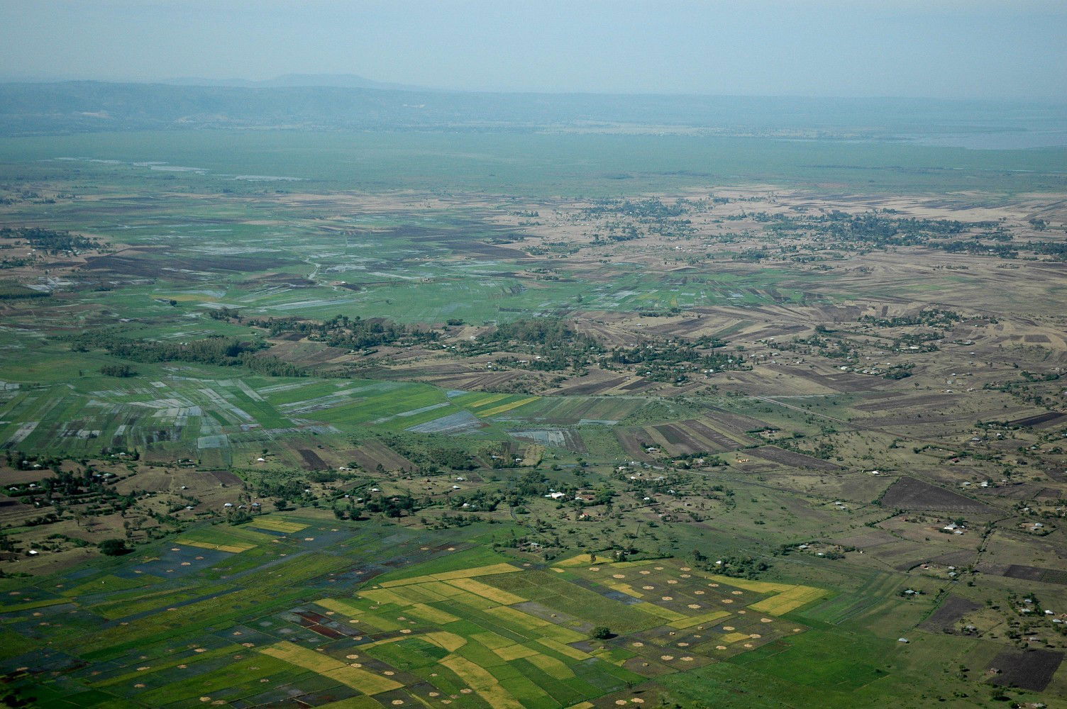 Commercial rice and smallholding agriculture, Kisumu, 2013 Commercial rice and smallholding agriculture, Kisumu, 2013 | 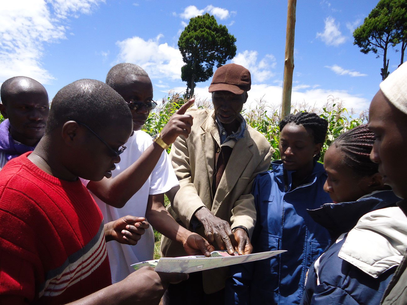 Ground-truthing APS crop interpretation, Eldoret, 2013 Ground-truthing APS crop interpretation, Eldoret, 2013 |